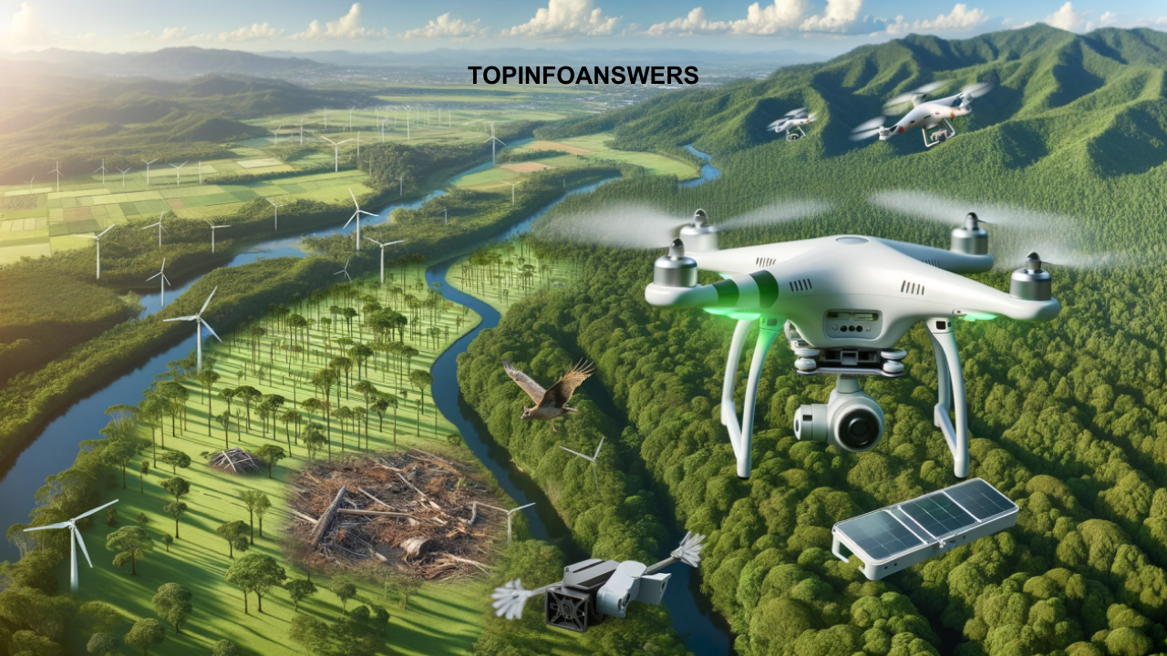
In recent years, drones have emerged as a powerful tool in environmental conservation, revolutionizing the way conservationists monitor and protect ecosystems, wildlife, and natural resources. With their ability to access difficult-to-reach areas, capture high-resolution imagery, and collect real-time data, drones have become indispensable in helping environmental scientists and organizations make informed decisions to preserve biodiversity, combat climate change, and protect fragile ecosystems. This article explores how drones are being used in various environmental conservation projects, highlighting their role in monitoring wildlife, tracking deforestation, mapping ecosystems, and supporting climate change mitigation efforts.
1. Introduction to Drones in Environmental Conservation
Drones, also known as unmanned aerial vehicles (UAVs), are aircraft that are operated remotely or autonomously without a human pilot on board. Initially developed for military purposes, drones have found applications in a wide range of industries, including agriculture, infrastructure inspection, and environmental conservation. Equipped with cameras, sensors, and GPS technology, drones can fly at various altitudes and capture data from the air with precision and efficiency.

In environmental conservation, drones provide a non-invasive and cost-effective means of monitoring and collecting data from vast or inaccessible areas. They are used in various capacities, from aerial surveillance to data analysis, helping conservationists make data-driven decisions to improve environmental outcomes. The ability to monitor large areas quickly, gather high-resolution imagery, and access remote or hazardous locations gives drones a significant advantage over traditional conservation methods.
2. Wildlife Monitoring and Conservation
One of the most significant applications of drones in environmental conservation is wildlife monitoring. Drones are used to track and monitor animal populations, migration patterns, and behaviors, particularly for endangered species. Traditional wildlife monitoring methods, such as ground-based surveys and tracking collars, can be labor-intensive, costly, and disruptive to the animals. Drones, on the other hand, offer a non-invasive and efficient alternative.
A. Tracking Endangered Species
Drones are particularly valuable for monitoring endangered species in remote or hard-to-reach areas. For example, conservationists use drones to monitor the movements of endangered species like elephants, rhinos, and tigers, helping to protect them from poaching and habitat loss. Drones can capture high-resolution images or thermal footage of animals from the sky, allowing conservationists to gather data without disturbing the animals or their habitats.
In Africa, drones are being used to monitor elephant populations in the savannahs. By using thermal cameras, drones can detect the heat signatures of elephants even in dense forests or during the night, making it easier for conservationists to track their movements. This data helps park rangers respond quickly to potential poaching threats or other dangers to the animals.
B. Monitoring Bird Populations
Drones are also used to monitor bird populations, especially in regions where traditional surveys are difficult or dangerous to conduct. For example, drones have been used to track migratory bird populations in wetlands, helping researchers gather valuable data on nesting sites and migration patterns. This information is essential for understanding the health of bird populations and making informed decisions about habitat protection.
In addition to tracking birds in the wild, drones are also used to monitor seabird colonies. In remote coastal areas, where human access is limited, drones can fly over large colonies of seabirds, capturing images of nesting sites, egg counts, and the presence of predators. This non-intrusive approach helps researchers gather essential data while minimizing disturbance to the birds.
3. Tracking Deforestation and Habitat Loss
Another critical use of drones in environmental conservation is monitoring deforestation and habitat loss. Deforestation is a significant global issue that contributes to climate change, biodiversity loss, and soil erosion. Drones equipped with high-resolution cameras and LIDAR (Light Detection and Ranging) technology are used to map forests, monitor tree cover, and track illegal logging activities.
A. Mapping Forests and Vegetation
Drones are capable of capturing high-resolution images of forests, creating detailed maps that help conservationists assess the health of forest ecosystems. These maps can identify areas of deforestation, degradation, or illegal logging, enabling authorities to take action before significant damage occurs. Drones also provide real-time data, which is critical for rapid decision-making in conservation efforts.

For example, drones are being used in the Amazon rainforest to monitor deforestation and track illegal logging activities. Drones can cover large areas of the forest in a short amount of time, providing detailed imagery of tree cover loss and identifying areas that require immediate attention. This helps conservation organizations and government agencies take quick action to protect the forest and its biodiversity.
B. Monitoring Forest Regeneration
Drones are not only used to track deforestation but also to monitor the regeneration of forests. In areas where reforestation or afforestation projects are underway, drones are used to monitor the progress of planting efforts. Drones can capture aerial images of newly planted trees, assess their growth, and determine whether they are thriving in their environment.
Drones can also be used to assess the effectiveness of restoration efforts by comparing images over time. This data helps conservationists understand which methods are most effective in promoting forest regeneration, enabling them to adjust their strategies for better outcomes.
4. Ecosystem Mapping and Habitat Restoration
Drones are also invaluable tools for mapping ecosystems and supporting habitat restoration projects. Ecosystem mapping involves creating detailed, high-resolution maps of landscapes to understand the distribution of plant and animal species, the condition of habitats, and the health of ecosystems. These maps are essential for guiding conservation efforts, as they provide baseline data for assessing the impact of conservation activities.
A. Mapping Wetlands and Coastal Areas
Drones are used to map wetlands and coastal ecosystems, which are vital for biodiversity and provide numerous ecosystem services, such as carbon sequestration and water purification. Wetlands are often challenging to monitor due to their inaccessibility and the complexity of their environments. Drones, however, can provide a bird’s-eye view of these areas, capturing detailed images of vegetation, water levels, and wildlife.
In coastal areas, drones are used to monitor coral reefs, which are highly vulnerable to climate change, pollution, and overfishing. By using drones to capture images of coral reefs, researchers can assess the health of these ecosystems and identify areas that require protection or restoration efforts.
B. Supporting Habitat Restoration
In addition to mapping ecosystems, drones are used to support habitat restoration efforts. Drones can assist in planting vegetation in degraded areas, such as grasslands, forests, and wetlands. For example, drones equipped with seed-dropping mechanisms can disperse seeds over large areas, promoting vegetation growth and restoring ecosystems. This method is faster and more cost-effective than traditional hand-planting methods, allowing conservation organizations to cover large areas in a short amount of time.
Drones are also used to monitor the progress of habitat restoration projects, ensuring that restored ecosystems are thriving. By capturing aerial imagery of the restored areas, conservationists can assess the success of restoration efforts and make adjustments if necessary.
5. Supporting Climate Change Mitigation and Research
Climate change is one of the most pressing environmental challenges of our time, and drones are playing a crucial role in mitigating its effects. Drones are used to monitor the impacts of climate change on ecosystems, track greenhouse gas emissions, and collect data for climate research.
A. Monitoring Greenhouse Gas Emissions
Drones equipped with sensors can be used to measure greenhouse gas emissions, particularly in areas where emissions are difficult to monitor, such as industrial sites, oil fields, and landfills. By collecting data on carbon dioxide, methane, and other greenhouse gases, drones provide valuable information for climate change research and policy-making.

In addition to measuring emissions, drones can also monitor carbon sequestration efforts. Forests, wetlands, and grasslands play a critical role in capturing and storing carbon dioxide from the atmosphere. Drones are used to monitor these carbon sinks, helping scientists understand how much carbon is being stored and how these ecosystems are responding to climate change.
B. Assessing Climate Change Impacts
Drones are used to assess the impacts of climate change on ecosystems and wildlife. For example, drones have been used to monitor the melting of glaciers, rising sea levels, and changes in vegetation patterns due to climate change. This data is essential for understanding the rate of climate change and predicting its future impacts.
In addition, drones can be used to monitor the health of ecosystems that are particularly vulnerable to climate change, such as polar regions, coral reefs, and tropical forests. By gathering data on these ecosystems, drones provide valuable insights into the effects of climate change and help conservationists develop strategies to protect vulnerable species and habitats.
Drones are proving to be an invaluable tool in environmental conservation, offering a cost-effective, non-invasive, and efficient way to monitor ecosystems, track wildlife, combat deforestation, and support climate change mitigation efforts. With their ability to access remote areas, capture high-resolution imagery, and collect real-time data, drones are revolutionizing the way conservationists approach environmental protection. As drone technology continues to advance, their role in environmental conservation will only grow, enabling a more sustainable future for our planet’s ecosystems and wildlife.
In the years to come, drones will likely become even more integrated into conservation strategies, helping to ensure that the planet’s most fragile and valuable ecosystems are protected for future generations.